Reading the September 2026 Typhoon Status: The Difference Between ‘None Currently’ and Seasonal Risk
As of September 1, 2026, the Korea Meteorological Administration had no active typhoon or tropical depression information, but this was not a prediction that no typhoons would occur throughout September. To interpret typhoon information accurately, it is necessary to distinguish the current status, climatological averages, and uncertainty in forecast tracks.
‘No active typhoons’ on September 1, 2026, described conditions at the time of the query and was not an outlook for the entire month of September.
According to Korea Meteorological Administration statistics, an average of 5.1 typhoons form in the northwestern Pacific in September, but this average is not a forecast that exactly five will form in September 2026.
The number of typhoons formed refers to all typhoons generated in the northwestern Pacific, while the number of typhoons affecting Korea is counted separately from among them.
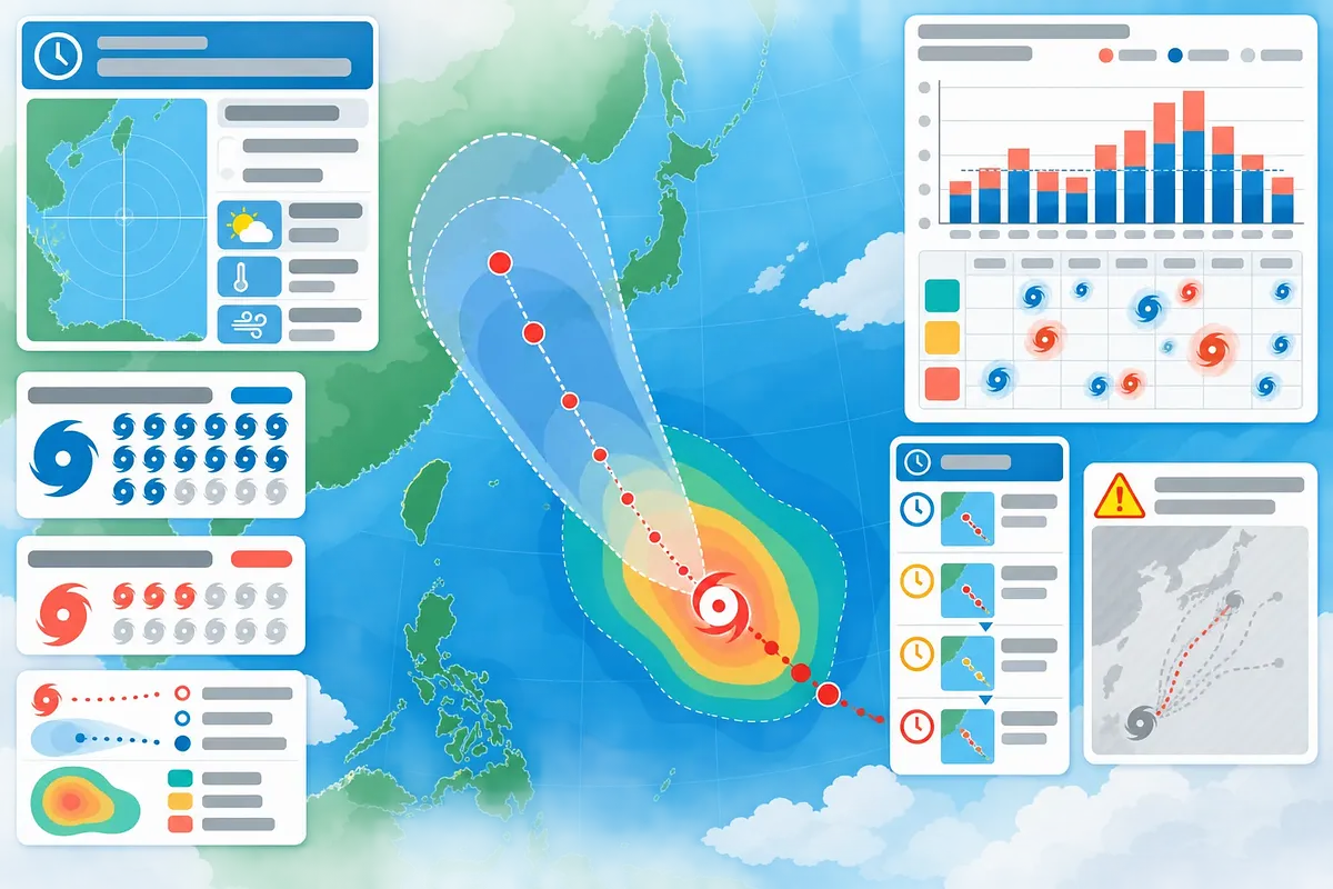
The probability radius of a forecast track indicates uncertainty in the center’s location, while the strong-wind radius indicates the area experiencing winds at or above a specified speed.
When assessing typhoons, priority should be given to the Korea Meteorological Administration’s issuance times, latest bulletins, warnings and advisories, and risk timing information rather than long-range track images from unknown sources.
As of September 1, 2026, the Korea Meteorological Administration’s detailed typhoon information showed no active typhoons or tropical depressions. However, this indicated only that there were no systems being monitored or reported on at the time of inquiry; it was not a seasonal outlook stating that no typhoons would occur throughout September or affect South Korea.
According to official Korea Meteorological Administration statistics, the normal number of typhoons forming in the northwestern Pacific in September is 5.1. This figure provides the climatological context that typhoons can remain active in September, but it cannot be used as a forecast that predetermines the number or tracks of typhoons in a particular year.
What the Status as of September 1, 2026 Means
“There are currently no reported typhoons” has a clear time frame. It means that when the relevant page was checked on September 1, 2026, the Korea Meteorological Administration was not issuing detailed information on any typhoons or tropical depressions.
The following table shows what can and cannot be determined from this status.
Category | What can be determined | What cannot be determined
Detailed typhoon information is blank | There were no typhoons or tropical depressions under active reporting at the time of inquiry | No typhoons will form throughout September
No current domestic typhoon advisories or warnings | No areas are currently subject to advisories or warnings | There will be no impact several days or weeks later
Normal number of September typhoons: 5.1 | The average level of September activity during the past normal period | The actual number and tracks of typhoons in September 2026
Media coverage of seasonal risks | Background information and expert commentary explaining why vigilance is necessary | A substitute for official typhoon locations, intensities, advisories, and warnings
If a tropical depression develops into a typhoon, the status shown on the page may change. Therefore, when citing the word “none,” the date and time of inquiry must always be recorded as well.
The Precise Meaning of the Normal September Figure of 5.1
The normal September figure of 5.1 provided in the Korea Meteorological Administration’s typhoon statistics is the long-term average number of typhoons that form in the northwestern Pacific during September. The decimal is the result of averaging the number of typhoons over multiple years; it does not mean that 0.1 of a typhoon forms in a single year.
This statistic should be interpreted as follows.
· It is a climate statistic. It is not a probability directly calculating the likelihood of a typhoon forming on a particular date.
· It covers the entire month. Even if there is no typhoon as of September 1, typhoons that form later may be included in the monthly total.
· It applies to the northwestern Pacific. Not every typhoon that forms moves toward the Korean Peninsula.
· The average and the actual result may differ. Some years may have more typhoons than average, while others may have fewer.
· The normal period and counting criteria must be checked. When citing the statistics, it is advisable also to verify the normal period, formation criteria, and definition of an affecting typhoon displayed on the Korea Meteorological Administration’s statistics page.
Therefore, the figure of 5.1 can explain the seasonal context that “the risk in September is not over,” but it is not a basis for predicting the number of typhoons in September 2026 or definitively asserting damage in a particular area.
The Difference Between the Number Formed from January to August 2026 and the Number Affecting South Korea
One of the most common errors when reading typhoon statistics is treating “typhoons formed” and “typhoons affecting South Korea” as the same number.
Indicator | What is counted | Points to note when interpreting
Number formed | All systems that formed as typhoons in the northwestern Pacific | May include typhoons that traveled far from South Korea
Number affecting South Korea | Typhoons that, among those formed, affected South Korea under Korea Meteorological Administration criteria | Does not necessarily mean only typhoons that made landfall on the Korean Peninsula
Number of landfalls | Cases in which the center of a typhoon made landfall on a particular landmass | Typhoons that do not make landfall can still cause damage through strong winds, heavy rain, high waves, and swells
Number currently reported | Typhoons and tropical depressions for which detailed information was being issued at the time of inquiry | Different from the cumulative number formed since the beginning of the year
To verify the cumulative number formed from January to August 2026, the monthly formation figures for 2026 must be added together in the Korea Meteorological Administration’s typhoon statistics, or the annual cumulative total must be checked. The number affecting South Korea must be checked under a separate category or in the annual list of typhoons affecting South Korea. Because the statistics page may be updated, it is advisable to include the inquiry date and counting period when reproducing figures.
The fact that the detailed typhoon information was blank on September 1 does not reduce the cumulative number formed from January through August to zero. The number of currently active typhoons and the cumulative number of typhoons already formed during the year are different indicators.
Differences Among Detailed Typhoon Information, Typhoon Bulletins, and Risk Timing Information
The Korea Meteorological Administration’s typhoon-related pages do not merely repeat the same content; they answer different questions.
Detailed Typhoon Information
This information is used to identify the location and movement of typhoons or tropical depressions currently being monitored and reported on. It generally includes the center location, central pressure, maximum wind speed, movement direction and speed, intensity, size or wind field, and forecast positions.
This page is useful for checking “what typhoon currently exists, where it is, and how it is analyzed as likely to move.” However, even if the page is blank, that does not rule out the possibility that a new tropical depression may later form or develop.
Typhoon Bulletins
A bulletin provides the current status and outlook of a typhoon as analyzed by the Korea Meteorological Administration at a specific issuance time. Even for the same typhoon, the center location, intensity, and forecast track may change when new observations and numerical forecast results are incorporated.
When comparing bulletins, the following items should be checked first.
· Confirm that the issuing organization is the Korea Meteorological Administration.
· Check the issuance date and time.
· Distinguish between the reference times for the current and forecast positions.
· Confirm that it is the latest bulletin rather than an earlier one.
· Review the intensity, wind field, advisories, and warnings as well as the forecast track.
Risk Timing Information
When a typhoon is expected to affect South Korea, risk timing information helps users understand the periods when risks may begin or intensify in each region. The items provided and the regions covered may vary depending on the typhoon conditions at the time.
The displayed times are not fixed commitments. If the typhoon’s speed or track changes, the expected start and end times of the risk may also change, so the latest bulletins, advisories, and warnings must be checked together.
Why the Probability Radius and Strong-Wind Radius Must Not Be Confused
A typhoon forecast-track map may show two types of areas with entirely different meanings.
The Probability Radius Represents Uncertainty in the Center Position
On the Korea Meteorological Administration’s forecast track, the probability radius indicates the range of uncertainty regarding the typhoon’s center position at the relevant forecast time. The specific probability criterion must be checked in the Korea Meteorological Administration’s detailed typhoon information. A wider radius indicates greater uncertainty about the future center position.
The probability radius does not mean the following.
· It does not represent the probability of damage in every area within the radius; the specific probability criterion must be checked in the Korea Meteorological Administration’s detailed typhoon information.
· It does not mean that areas outside the radius are safe.
· It is not a circle representing the typhoon’s size or strong-wind field.
· It does not guarantee that the typhoon will move precisely along the line in the center of the map.
The forecast centerline is a line representing a possible track. The actual center may follow another path within the probability radius, and both the centerline and radius may change when the forecast is updated.
The Strong-Wind Radius Shows the Actual Wind Field
The strong-wind radius is the area analyzed as likely to experience winds at or above a certain speed from the typhoon’s center. The threshold wind speed must be checked in the legend of the Korea Meteorological Administration’s detailed typhoon information. When a storm-wind radius is shown separately, it indicates an area of stronger winds, and the threshold wind speed must be checked in the legend of the Korea Meteorological Administration’s detailed typhoon information.
The wind field may not form a perfect circle. Depending on the typhoon’s direction of movement and the surrounding pressure systems, the radius may extend farther in certain directions. Areas far from the centerline may still fall within the strong-wind radius, and even if the center does not make landfall, they may be affected by strong winds, heavy rain, high waves, and swells.
Map element | What it shows | Key question
Forecast center points and centerline | Representative center positions and movement direction at each forecast time | In which direction is the center expected to move?
Probability radius | Forecast uncertainty regarding the future center position | How broad is the range within which the center position may vary?
Strong-wind radius | Area with winds of at least 15 m/s | Do strong winds extend to areas far from the center?
Storm-wind radius | Area with winds of at least 25 m/s | How far does the stronger-wind field extend?
Why Long-Range Track Images from Unidentified Sources Are Dangerous
An image that fixes a single landfall point on the Korean Peninsula several days or weeks in advance, even though a typhoon has not yet formed, is unlikely to be an official typhoon forecast. It may be the result of a single numerical forecast model run, an outdated run, or a repurposed image from which the source has been removed.
When evaluating a long-range track image, the following should be checked.
· Whether a typhoon has actually formed and been assigned an official number or name
· Whether the organization that produced and issued it is identified
· Whether both the model initialization time and forecast target time are provided
· Whether it is a single deterministic result or ensemble data showing multiple scenarios
· Whether the image was created before the latest Korea Meteorological Administration bulletin
Before a tropical depression forms, its center position and structure have not themselves been established. As the forecast extends further into the future, small differences in atmospheric flow can greatly alter the track and whether the system develops. Therefore, a single model result must not be interpreted as an actual typhoon track.
How to Verify Information Based on Its Issuance Time
The accuracy of typhoon information depends not only on its source but also on its timing. Even information from the same organization may fail to reflect the latest observations and forecasts if it was issued earlier. This is a critical procedure for filtering out outdated screens during a disaster, not merely a routine information check.
It is reasonable to check information in the following order.
· Check the Korea Meteorological Administration’s detailed typhoon information to determine whether any systems are currently under active reporting.
· Check the issuance time and typhoon status in the latest bulletin.
· Check whether weather advisories, warnings, and regional risk timing information are available.
· Use typhoon statistics to understand the seasonal context, not as current warnings.
· Compare media reports and social media images against the issuance times and figures in official information.
When sharing screenshots, ensure that the issuance time is not cropped out. Images containing only phrases such as “today,” “currently,” or “landfall soon” may take on a different meaning over time and cause misunderstandings.
Key Principles for Assessing September Typhoon Risk
The fact that no typhoons were under active reporting on September 1, 2026, does not conflict with the statistic that the normal number of September typhoons is 5.1. The former is the observation and reporting status at a specific time, while the latter is a climate statistic averaged across September in multiple years.
Current risks should be assessed using the latest detailed information, bulletins, advisories, and warnings, while normal statistics should be used to explain why seasonal vigilance remains necessary. Even after a forecast track is issued, users should not look only at a single centerline; they should also check the probability radius, strong-wind radius, intensity changes, and issuance time.
Frequently Asked Questions
If There Is No Typhoon on September 1, Is September Safe?
No. It means that no typhoons or tropical depressions were under active reporting at the time of inquiry on that date. A new tropical depression may subsequently form and develop into a typhoon, so this does not guarantee safety throughout September.
Does the Normal September Figure of 5.1 Mean That Five Typhoons Will Form in 2026?
No. It is a climate statistic calculated by averaging the number of typhoons formed in September over multiple years. The actual number in 2026 may be higher or lower than the average, and the decimal value is the result of the averaging calculation.
Does Every Typhoon That Forms in the Northwestern Pacific Affect South Korea?
No. Many travel through waters far from South Korea or dissipate without affecting land. The number formed and the number of typhoons affecting South Korea must be counted separately.
If a Typhoon Does Not Make Landfall, Is It Not Considered an Affecting Typhoon?
Not necessarily. Even if the center does not make landfall, it may affect South Korea through its strong-wind field, moisture inflow, torrential rain, high waves, and swells. The Korea Meteorological Administration’s counting criteria must be checked for the official classification of typhoons affecting South Korea.
Does a Typhoon Move Precisely Along the Forecast-Track Line?
No. The line connects the representative center positions at each forecast time. The actual center may move along a different path within the probability radius, and the forecast track may change when new observations are incorporated.
Does Being Within the Probability Radius Mean There Is a 70% Probability of Damage?
No. This figure relates to the forecast position of the typhoon’s center, and the specific criterion must be checked in the Korea Meteorological Administration’s detailed typhoon information. It does not directly indicate the probability of damage in an individual area. The potential for damage must be assessed by considering the strong-wind radius, precipitation forecast, terrain, advisories, and warnings together.
Is It Safe Outside the Strong-Wind Radius?
The strong-wind radius represents a wind field based on a specific wind-speed threshold, so it is not the boundary of every hazard. Heavy rain, gusts, high waves, swells, or landslide risks may also occur outside the radius, so regional forecasts, advisories, and warnings must be checked separately.
If Media Reports and Korea Meteorological Administration Bulletins Differ, Which Should Take Priority?
The latest Korea Meteorological Administration announcements should take priority for the current position, intensity, forecast track, advisories, and warnings. Media reports provide background and commentary, but official forecasts may have been updated after the report was written or broadcast, so the time of the report must also be checked.
 Injoys