Skip to content
Injoys
Knowledge Base 🇰🇷 South Korea

This content applies specifically to South Korea.

How to Read 2026 Typhoon Intensity Numbers and Five-Stage Heavy Rain Information

Starting June 1, 2026, typhoon intensity will be shown with numbered icons, and land alert zones have been subdivided into 235 areas. This explains typhoon intensity numbers, heavy rain likelihood information, preliminary advisories, advisories, warnings, emergency disaster alerts, and evacuation principles for different situations.

Listen or read this article

14:04

Listen, or read the text only.

How to Read 2026 Typhoon Intensity Numbers and Five-Stage Heavy Rain Information

Kokoro 82M AI-generated voice

0:00 14:04

Advertisement

Download audio

File name
2026-korea-typhoon-heavy-rain-alert-guide-en.mp3
Format
MP3 (audio/mpeg)
Duration
14:04
File size
9.66 MB
Engine
Kokoro 82M

This audio was generated by AI.

You may download and use it freely for personal use.

How to Read 2026 Typhoon Intensity Numbers and Five-Stage Heavy Rain Information

11 min read

How to Read 2026 Typhoon Intensity Numbers and Five-Stage Heavy Rain Information
Starting June 1, 2026, typhoon intensity will be shown with numbered icons, and land alert zones have been subdivided into 235 areas. This explains typhoon intensity numbers, heavy rain likelihood information, preliminary advisories, advisories, warnings, emergency disaster alerts, and evacuation principles for different situations.
Typhoon intensity numbers divide the maximum wind speed near the center into five ranges, with higher numbers indicating stronger winds.
Heavy rain information can be read as likelihood information, preliminary advisories, advisories, warnings, and emergency disaster alerts, but they are not always issued in that order.
Land alert zones have been subdivided from 183 to 235, so alerts may differ by location even within the same city or county.
When you receive a disaster alert, do not remain in a dangerous place to check the situation; first leave underground spaces, riversides, and flooded roads.
The expected time for lifting heavy rain alerts in the Seoul metropolitan area is a changeable forecast intended to assist planning and does not replace an official lifting announcement.
Effective June 1, 2026, the Korea Meteorological Administration changed its disaster weather information system. Typhoon intensity is now displayed with numeric icons, and land weather warning areas have been divided into smaller zones. In the Seoul metropolitan area, information on when heavy rain warnings are expected to be lifted is also being provided on a trial basis.
The purpose of these changes is to communicate risks more quickly and in a more location-specific manner. However, safety should not be judged based on a single number or one emergency alert. Typhoon intensity is a wind indicator, while heavy rain warnings reflect expected rainfall and duration, and actual flood risk also varies depending on terrain and drainage conditions.
What Typhoon Intensity Numbers and Colors Mean
The number on the new typhoon icon represents the range of maximum wind speeds near the typhoon’s center. The previous letter-based intensity labels have been replaced with numbers so that intensity can be distinguished quickly on maps and small screens.
Number | Maximum wind speed near the center | Corresponding previous label | Basic interpretation 1 | Check the latest legend in Korea Meteorological Administration typhoon information | No intensity classification | Qualifies as a typhoon and may affect weak structures and outdoor facilities 2 | Check the latest legend in Korea Meteorological Administration typhoon information | Moderate | Increased risk to roofs, signs, trees, and maritime activities 3 | Check the latest legend in Korea Meteorological Administration typhoon information | Strong | A very strong wind range described as capable of derailing trains 4 | Check the latest legend in Korea Meteorological Administration typhoon information | Very strong | A range described as powerful enough to send people or large rocks flying 5 | Check the latest legend in Korea Meteorological Administration typhoon information | Super strong | The highest intensity range, described as powerful enough to cause buildings to collapse
Colors also help identify the same intensity levels as the numbers. In other words, the numbers and colors do not represent different hazards. Because colors may be affected by differences in color perception, screen settings, or black-and-white printing, do not rely on color alone; check the number and legend together.
What the Number Does Not Tell You
A typhoon intensity number summarizes the maximum wind speed near the typhoon’s center. The following information is not included in that single number.
· The actual wind strength at my location · The radius of strong winds and the radius of storm-force winds · Expected rainfall and how long the rain will continue · The risk of storm surges and high waves · The likelihood of landslides, river flooding, and urban flooding · Uncertainty in the forecast track
Therefore, even a weakening typhoon can cause severe rain damage if it supplies large amounts of moisture or moves slowly. Conversely, locations far from the center may also be at risk if they fall within the radius of strong winds or a rainband.
How the Five Levels of Heavy Rain Information Differ
Heavy rain disaster information can be read in practical terms as the following five signals. Rather than a fixed escalation sequence, these are groups of information that differ in the amount of lead time and urgency of the risk.
Category | Meaning | What users should do Heavy rain possibility information | An outlook issued in advance to indicate the possibility of heavy rain in the future; check the Korea Meteorological Administration announcement for the applicable period | Adjust schedules and travel routes, and inspect drains, flood barriers, and emergency supplies. Preliminary heavy rain advisory | Provides advance notice of areas where an advisory or warning is increasingly likely and when it is expected | Cancel or move outdoor activities earlier, and place evacuation plans for underground spaces and riverside areas into a ready-to-execute state. Heavy rain advisory | Check the latest weather warning issuance criteria on the Korea Meteorological Administration’s Weather Nuri website for the specific criteria | Stop approaching hazardous locations and move vulnerable people and facilities first. Heavy rain warning | Check the latest weather warning issuance criteria on the Korea Meteorological Administration’s Weather Nuri website for the specific criteria | Immediately remain in a safe place and follow evacuation orders in areas at risk of flooding, overflow, or landslides. Emergency alert | Delivers a mobile phone alert when extreme heavy rain is observed or immediate action is required | Prioritize leaving the hazardous location over reading the message, and follow restrictions imposed by local governments, fire authorities, and police.
Advisory and warning criteria use not only cumulative rainfall but also the amount of rain expected over a specified period. Even the same amount of rain is more likely to exceed drainage capacity if it is concentrated within a short time.
The Five Levels Do Not Always Arrive in Order
If rain clouds develop rapidly, a warning may be issued without sufficient time for possibility information or a preliminary advisory. Conversely, after a preliminary advisory is issued, the rain clouds may weaken more than expected and no formal advisory or warning may follow.
An emergency alert is also not a final stage automatically sent after every heavy rain warning. It should be understood as action-oriented information sent under separate urgent conditions, such as when extreme rainfall is actually observed. You should not assume that your current location is safe simply because you have not received an alert.
How to Check the 235 Subdivided Warning Zones
Effective June 1, 2026, the Korea Meteorological Administration subdivided its land warning zones from 183 to 235. This measure is intended to reflect differences in weather and terrain more specifically rather than applying the same warning to an entire administrative district.
It may no longer be enough to check only the name of a city or county in the news. Even within the same city or county, the timing of a warning’s issuance and lifting may differ depending on whether the area is mountainous, coastal, urban, or within a particular administrative subdivision.
The following sequence is useful when checking.
· Zoom in on your current location on the weather warning map on the Korea Meteorological Administration’s Weather Nuri website. · Do not rely only on the map’s colors; check the zone name shown in the warning status list. · Compare not only the city, county, or district of your current location but also the town, township, neighborhood, or subdivided zone. · If your commute or planned destination is in another zone, separately check the warnings for your destination and travel route. · Rain in upstream areas or nearby mountains may affect your location, so also check warnings for surrounding zones.
Mobile phone location data may be inaccurate indoors or in mountainous areas. It is safer not to rely solely on location-based alerts but to directly check the administrative district and terrain where you are.
How to Read the Expected Lifting Time for Heavy Rain Warnings in the Seoul Metropolitan Area
Information on when heavy rain warnings are expected to be lifted is being piloted in the Seoul metropolitan area. It is intended to support decisions involving restrictions, evacuations, and transportation operations rather than leaving people to wait without knowing when the rain will stop.
However, the expected lifting time is not a confirmed end time. If the development and movement speed of rain clouds change, the expected time may be moved earlier or delayed. Even after the expected time has passed, the warning remains in effect until the Korea Meteorological Administration officially lifts it.
Moreover, the lifting of a warning does not mean that all risks end at the same time. Water flowing down from upstream may cause river levels to rise later, or landslides may occur after the ground has weakened. Whether restrictions on underpasses and riverside roads have been lifted must be checked separately through announcements from the relevant authorities.
Priority Actions by Location When You Receive an Emergency Alert
An emergency alert may be a signal requiring immediate action, not a notification asking you to analyze information in detail. Check the affected area, type of hazard, and any restriction or evacuation instructions stated in the message, but do not remain in a dangerous place while searching for additional information.
When You Are in an Underground Space
· If water begins entering an underground parking garage, semi-basement home, or underground shopping center, move above ground rather than trying to retrieve your vehicle or belongings. · Do not re-enter an underground space that is flooding. · Because of the risk of power outages and being trapped, use a safe stairway rather than an elevator. · If water is rushing rapidly through an entrance, do not attempt to force your way across the current; follow evacuation guidance from the building manager and instructions from rescue authorities.
When You Are Near a River, Valley, or Floodplain
· Move away from the river or valley to higher ground before the water level rises noticeably. · Do not return to the riverside to retrieve parked vehicles, tents, or fishing equipment. · Do not cross routes that may be submerged, such as low-water bridges, stepping-stone crossings, or submerged bridges. · Keep in mind that water levels may rise suddenly because of torrential rain upstream, even if the rain is currently light where you are.
When You Are Driving
· Do not enter flooded roads, underpasses, or riverside roads; take a detour. · Do not enter a section where the water depth and current are not visible simply because the vehicle ahead passed through. · If your vehicle begins to flood, immediately move to a safe place while you still can, and prioritize people’s escape over preserving the vehicle. · Do not enter sections closed by the police, fire authorities, or road management authorities, even if navigation directs you that way.
An Easily Overlooked Point: Your Location Matters More Than the Warning Level
Even within the same heavy rain advisory zone, underpasses, semi-basement homes, steep slopes, and areas around small streams may become dangerous much sooner than high-rise buildings on level ground. An official warning communicates shared risks across a broad area; it is not a determination guaranteeing the safety of an individual building.
It is therefore safer to establish location-specific action criteria in advance rather than waiting for a higher warning level. For example, if there are signs of flooding in an underground space, river restrictions, or landslide evacuation guidance, you should move immediately even at the heavy rain advisory level.
How to Interpret the 2026 Summer Typhoon Outlook
The Korea Meteorological Administration has indicated that typhoon activity affecting South Korea in summer 2026 is likely to be similar to the seasonal average. In a seasonal outlook, “similar to the seasonal average” does not mean that individual typhoons will be weak or cause little damage.
A seasonal outlook describes overall trends over several months in probabilistic terms. The track and intensity of an individual typhoon become more specific in short-term forecasts after it forms, so actual response decisions should prioritize the latest typhoon information, weather warnings, emergency alerts, and local government restrictions.
0:00 0:00
1 / 48

Advertisement

Download text

File name
2026-korea-typhoon-heavy-rain-alert-guide-en.txt
Format
TXT (text/plain)
Paragraphs
48

Downloads exactly what you see as a text file.

Please cite the source when quoting.

Large text

Makes the text larger and the colors clearer. Turn it on if the text feels too small.

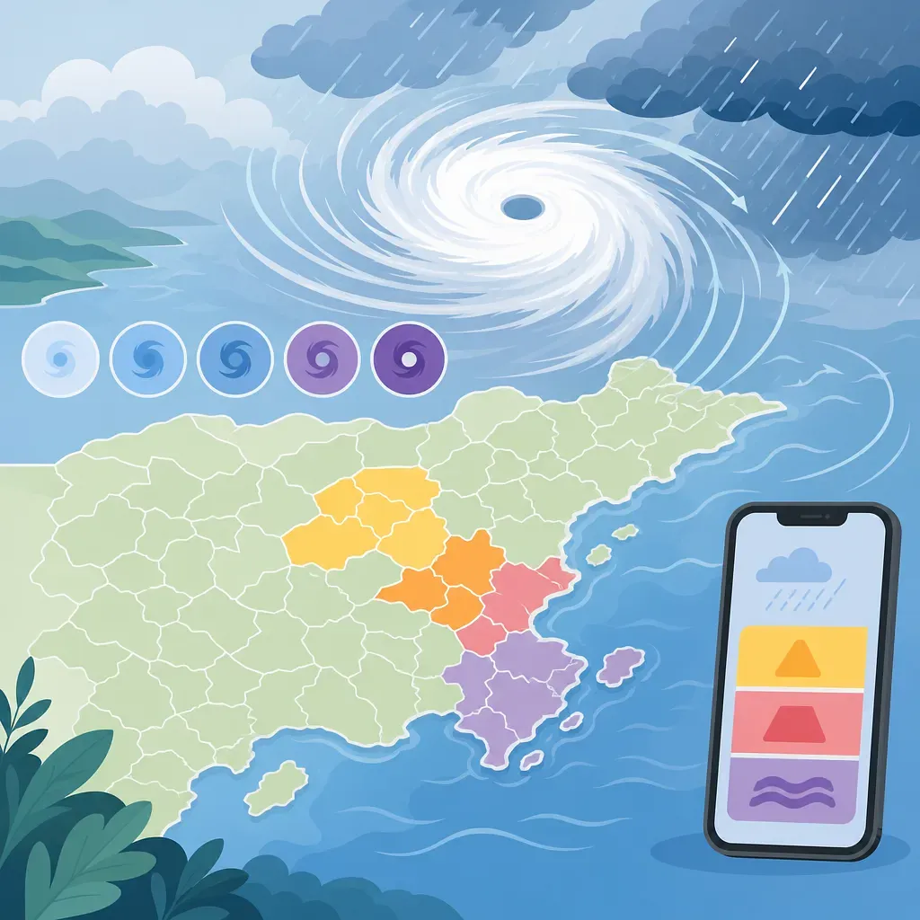
The illustration visualizes typhoon intensity and regional heavy-rain warning levels.

Key points

  • Typhoon intensity numbers divide the maximum wind speed near the center into five ranges, with higher numbers indicating stronger winds.
  • Heavy rain information can be read as likelihood information, preliminary advisories, advisories, warnings, and emergency disaster alerts, but they are not always issued in that order.
  • Land alert zones have been subdivided from 183 to 235, so alerts may differ by location even within the same city or county.
  • When you receive a disaster alert, do not remain in a dangerous place to check the situation; first leave underground spaces, riversides, and flooded roads.
  • The expected time for lifting heavy rain alerts in the Seoul metropolitan area is a changeable forecast intended to assist planning and does not replace an official lifting announcement.

Effective June 1, 2026, the Korea Meteorological Administration changed its disaster weather information system. Typhoon intensity is now displayed with numeric icons, and land weather warning areas have been divided into smaller zones. In the Seoul metropolitan area, information on when heavy rain warnings are expected to be lifted is also being provided on a trial basis.

The purpose of these changes is to communicate risks more quickly and in a more location-specific manner. However, safety should not be judged based on a single number or one emergency alert. Typhoon intensity is a wind indicator, while heavy rain warnings reflect expected rainfall and duration, and actual flood risk also varies depending on terrain and drainage conditions.

What Typhoon Intensity Numbers and Colors Mean

The number on the new typhoon icon represents the range of maximum wind speeds near the typhoon’s center. The previous letter-based intensity labels have been replaced with numbers so that intensity can be distinguished quickly on maps and small screens.

Number Maximum wind speed near the center Corresponding previous label Basic interpretation
1 Check the latest legend in Korea Meteorological Administration typhoon information No intensity classification Qualifies as a typhoon and may affect weak structures and outdoor facilities
2 Check the latest legend in Korea Meteorological Administration typhoon information Moderate Increased risk to roofs, signs, trees, and maritime activities
3 Check the latest legend in Korea Meteorological Administration typhoon information Strong A very strong wind range described as capable of derailing trains
4 Check the latest legend in Korea Meteorological Administration typhoon information Very strong A range described as powerful enough to send people or large rocks flying
5 Check the latest legend in Korea Meteorological Administration typhoon information Super strong The highest intensity range, described as powerful enough to cause buildings to collapse

Colors also help identify the same intensity levels as the numbers. In other words, the numbers and colors do not represent different hazards. Because colors may be affected by differences in color perception, screen settings, or black-and-white printing, do not rely on color alone; check the number and legend together.

What the Number Does Not Tell You

A typhoon intensity number summarizes the maximum wind speed near the typhoon’s center. The following information is not included in that single number.

  • The actual wind strength at my location
  • The radius of strong winds and the radius of storm-force winds
  • Expected rainfall and how long the rain will continue
  • The risk of storm surges and high waves
  • The likelihood of landslides, river flooding, and urban flooding
  • Uncertainty in the forecast track

Therefore, even a weakening typhoon can cause severe rain damage if it supplies large amounts of moisture or moves slowly. Conversely, locations far from the center may also be at risk if they fall within the radius of strong winds or a rainband.

How the Five Levels of Heavy Rain Information Differ

Heavy rain disaster information can be read in practical terms as the following five signals. Rather than a fixed escalation sequence, these are groups of information that differ in the amount of lead time and urgency of the risk.

Category Meaning What users should do
Heavy rain possibility information An outlook issued in advance to indicate the possibility of heavy rain in the future; check the Korea Meteorological Administration announcement for the applicable period Adjust schedules and travel routes, and inspect drains, flood barriers, and emergency supplies.
Preliminary heavy rain advisory Provides advance notice of areas where an advisory or warning is increasingly likely and when it is expected Cancel or move outdoor activities earlier, and place evacuation plans for underground spaces and riverside areas into a ready-to-execute state.
Heavy rain advisory Check the latest weather warning issuance criteria on the Korea Meteorological Administration’s Weather Nuri website for the specific criteria Stop approaching hazardous locations and move vulnerable people and facilities first.
Heavy rain warning Check the latest weather warning issuance criteria on the Korea Meteorological Administration’s Weather Nuri website for the specific criteria Immediately remain in a safe place and follow evacuation orders in areas at risk of flooding, overflow, or landslides.
Emergency alert Delivers a mobile phone alert when extreme heavy rain is observed or immediate action is required Prioritize leaving the hazardous location over reading the message, and follow restrictions imposed by local governments, fire authorities, and police.

Advisory and warning criteria use not only cumulative rainfall but also the amount of rain expected over a specified period. Even the same amount of rain is more likely to exceed drainage capacity if it is concentrated within a short time.

The Five Levels Do Not Always Arrive in Order

If rain clouds develop rapidly, a warning may be issued without sufficient time for possibility information or a preliminary advisory. Conversely, after a preliminary advisory is issued, the rain clouds may weaken more than expected and no formal advisory or warning may follow.

An emergency alert is also not a final stage automatically sent after every heavy rain warning. It should be understood as action-oriented information sent under separate urgent conditions, such as when extreme rainfall is actually observed. You should not assume that your current location is safe simply because you have not received an alert.

How to Check the 235 Subdivided Warning Zones

Effective June 1, 2026, the Korea Meteorological Administration subdivided its land warning zones from 183 to 235. This measure is intended to reflect differences in weather and terrain more specifically rather than applying the same warning to an entire administrative district.

It may no longer be enough to check only the name of a city or county in the news. Even within the same city or county, the timing of a warning’s issuance and lifting may differ depending on whether the area is mountainous, coastal, urban, or within a particular administrative subdivision.

The following sequence is useful when checking.

  1. Zoom in on your current location on the weather warning map on the Korea Meteorological Administration’s Weather Nuri website.
  2. Do not rely only on the map’s colors; check the zone name shown in the warning status list.
  3. Compare not only the city, county, or district of your current location but also the town, township, neighborhood, or subdivided zone.
  4. If your commute or planned destination is in another zone, separately check the warnings for your destination and travel route.
  5. Rain in upstream areas or nearby mountains may affect your location, so also check warnings for surrounding zones.

Mobile phone location data may be inaccurate indoors or in mountainous areas. It is safer not to rely solely on location-based alerts but to directly check the administrative district and terrain where you are.


How to Read the Expected Lifting Time for Heavy Rain Warnings in the Seoul Metropolitan Area

Information on when heavy rain warnings are expected to be lifted is being piloted in the Seoul metropolitan area. It is intended to support decisions involving restrictions, evacuations, and transportation operations rather than leaving people to wait without knowing when the rain will stop.

However, the expected lifting time is not a confirmed end time. If the development and movement speed of rain clouds change, the expected time may be moved earlier or delayed. Even after the expected time has passed, the warning remains in effect until the Korea Meteorological Administration officially lifts it.

Moreover, the lifting of a warning does not mean that all risks end at the same time. Water flowing down from upstream may cause river levels to rise later, or landslides may occur after the ground has weakened. Whether restrictions on underpasses and riverside roads have been lifted must be checked separately through announcements from the relevant authorities.

Priority Actions by Location When You Receive an Emergency Alert

An emergency alert may be a signal requiring immediate action, not a notification asking you to analyze information in detail. Check the affected area, type of hazard, and any restriction or evacuation instructions stated in the message, but do not remain in a dangerous place while searching for additional information.

When You Are in an Underground Space

  • If water begins entering an underground parking garage, semi-basement home, or underground shopping center, move above ground rather than trying to retrieve your vehicle or belongings.
  • Do not re-enter an underground space that is flooding.
  • Because of the risk of power outages and being trapped, use a safe stairway rather than an elevator.
  • If water is rushing rapidly through an entrance, do not attempt to force your way across the current; follow evacuation guidance from the building manager and instructions from rescue authorities.

When You Are Near a River, Valley, or Floodplain

  • Move away from the river or valley to higher ground before the water level rises noticeably.
  • Do not return to the riverside to retrieve parked vehicles, tents, or fishing equipment.
  • Do not cross routes that may be submerged, such as low-water bridges, stepping-stone crossings, or submerged bridges.
  • Keep in mind that water levels may rise suddenly because of torrential rain upstream, even if the rain is currently light where you are.

When You Are Driving

  • Do not enter flooded roads, underpasses, or riverside roads; take a detour.
  • Do not enter a section where the water depth and current are not visible simply because the vehicle ahead passed through.
  • If your vehicle begins to flood, immediately move to a safe place while you still can, and prioritize people’s escape over preserving the vehicle.
  • Do not enter sections closed by the police, fire authorities, or road management authorities, even if navigation directs you that way.

An Easily Overlooked Point: Your Location Matters More Than the Warning Level

Even within the same heavy rain advisory zone, underpasses, semi-basement homes, steep slopes, and areas around small streams may become dangerous much sooner than high-rise buildings on level ground. An official warning communicates shared risks across a broad area; it is not a determination guaranteeing the safety of an individual building.

It is therefore safer to establish location-specific action criteria in advance rather than waiting for a higher warning level. For example, if there are signs of flooding in an underground space, river restrictions, or landslide evacuation guidance, you should move immediately even at the heavy rain advisory level.

How to Interpret the 2026 Summer Typhoon Outlook

The Korea Meteorological Administration has indicated that typhoon activity affecting South Korea in summer 2026 is likely to be similar to the seasonal average. In a seasonal outlook, “similar to the seasonal average” does not mean that individual typhoons will be weak or cause little damage.

A seasonal outlook describes overall trends over several months in probabilistic terms. The track and intensity of an individual typhoon become more specific in short-term forecasts after it forms, so actual response decisions should prioritize the latest typhoon information, weather warnings, emergency alerts, and local government restrictions.

Sign-in required

Sign in with your Google account to like, comment, and save highlights.

Images

The illustration visualizes typhoon intensity and regional heavy-rain warning levels.
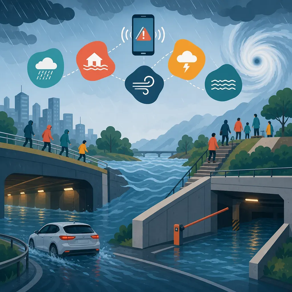
A typhoon and torrential rain flood roads and underground spaces as residents evacuate.

FAQ

Does typhoon intensity number 5 mean that the typhoon will definitely make landfall in Korea?

No. The number indicates the intensity category based on the maximum wind speed near the typhoon's center, and the specific criteria should be checked in the latest legend for the Korea Meteorological Administration's typhoon information. Whether it will make landfall and the area it will affect should be assessed separately by checking the forecast track, the radii of strong and storm-force winds, its movement speed, and regional forecasts.

If the typhoon intensity number decreases, does the risk of heavy rain also decrease?

Not necessarily. The typhoon intensity number is based on wind and does not directly indicate rainfall or flood risk. Even a weakened typhoon or tropical depression can supply large amounts of moisture and cause torrential rain.

What are the criteria for a heavy rain advisory and a heavy rain warning?

The specific rainfall criteria for heavy rain advisories and warnings should be checked in the latest criteria for issuing weather alerts on the Korea Meteorological Administration's Weather Nuri website. Actual alerts are issued based on a comprehensive assessment of the latest observations and forecasts.

Can a heavy rain advisory or warning be issued immediately even if there was no preliminary alert?

Yes. If rain clouds develop faster than expected, an alert may be issued without sufficient advance notice. The absence of a preliminary alert should not be used as grounds for assuming that it is safe.

Is an emergency disaster text message the highest level of heavy rain information?

An emergency disaster text message is separate information urging people to take action and is sent in situations requiring immediate action, such as when extreme heavy rain is observed. It is not a fixed final stage that is automatically sent after every heavy rain warning.

Can different neighborhoods in the same city have different heavy rain alerts?

Yes. Since June 2026, land weather alert areas have been subdivided into 235 areas, so alerts and their cancellation times may differ by sub-area even within the same city or county. The exact area name should be checked on the weather alert map and list.

Can I go outside after the expected cancellation time for a heavy rain alert has passed?

The expected time is not a confirmed cancellation time. You should check the actual cancellation announcement and whether the local government has lifted road and river restrictions. River levels may continue to rise and the risk of landslides may persist even after the rain stops.

What should I do if I encounter a flooded underpass while driving?

Do not enter it and take a detour immediately. It is difficult for drivers to accurately judge the water depth and current speed, and the water level can rise rapidly in a short time. In restricted areas, follow instructions from the police, fire department, and road management authorities rather than navigation guidance.

Sources

Data formats

This content is available in several machine-friendly formats.

Data-only languages (machine translated, files only)

Indonesian JSON MD Portuguese JSON MD Chinese (Traditional) JSON MD Deutsch JSON MD

Verification

Figures in this article were checked against the source material during generation. 10 correction(s) applied. · 2026-08-18

This translation has been cross-checked by AI. · 2026-08-18

Reuse & AI usage

Search indexing and AI citation with attribution are welcome. See the license policy for details.

CC BY · License

Loading…

Loading…

Related content

From Injoys

Request the content you want and take 70% of what it earns

Just leave the subject. We handle production, review, translation and distribution.

See how revenue sharing works

Comments